Deadeye Maps

Click on each map for a larger image.


General Simon Bolivar Buckner, Jr. Consulting a map on Okinawa

 
This map is from the inside cover of the book "Deadeyes" by Orlando R. Davidson. CLICK for larger map.
 

These Mem-O-Maps were sent to us by the grandson of Deadeye Clyde Tunk, dec.


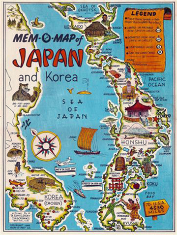
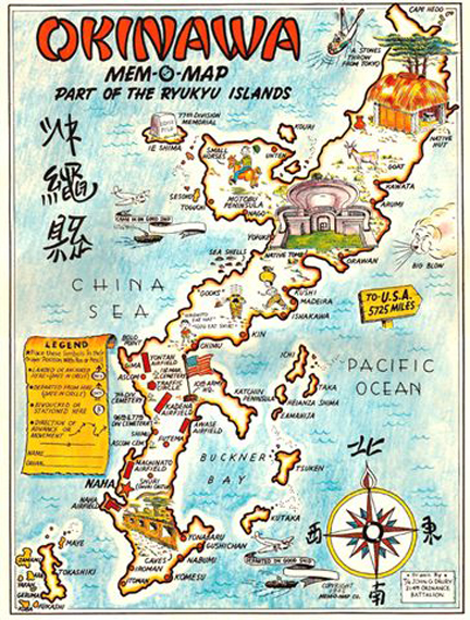
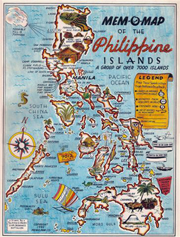
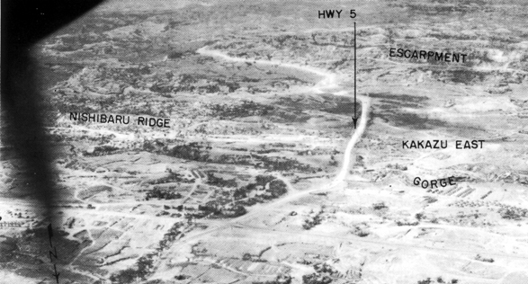
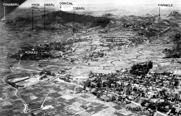
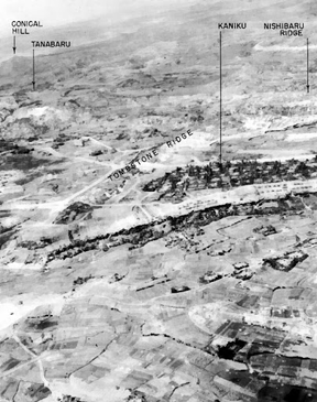
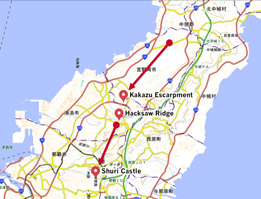
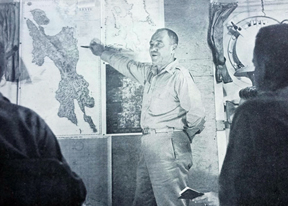
These maps are by John G. Drury, 214th Ordnance Battalion - US Govt.

It's an uncommon occurrence to find these ephemeral maps, they were a handout to service men at the end of World War II and were an intended memento their visit as well as a means to orientation. The legend on each map encouraged service men to note where they “landed or anchored” and when, as well as where they “bivoucked or stationed” while there. Some maps note the airfields as well as headquarters and all vignettes of local culture and people. Some, such as the Okinawa show locals with quotes like “Hirohito Eat Hat” “Tojo Eat Shirt”.

Quote from and sold by

The Old Map Gallery, Denver, CO


Path of the 96th Infantry
 
Leyte Area
 
Path of the Deadeyes
Map of the 96th Infantry Division by Deadeye, "Laz" Lazerick


General Bradley tells his staff the startling news - the division will by-pass Lap and instead land on Leyte.